

Ever felt the siren call of the untamed wilderness, only to be stymied by the labyrinthine nature of its trails? Fear not, intrepid explorer. The Pinhoti Trail, a serpentine path weaving through the heart of the American Southeast, awaits. But conquering this long-distance artery requires more than just sturdy boots and a thirst for adventure. A meticulously crafted map is your key to unlocking its scenic splendors and avoiding navigational pitfalls. Let’s embark on a cartographic journey to unveil the secrets of the Pinhoti Trail map, your indispensable companion for a successful thru-hike or a weekend escapade.
Deciphering the Topography: Understanding Contour Lines and Elevation Profiles
A Pinhoti Trail map is not merely a depiction of lines and symbols; it’s a sophisticated representation of the terrain itself. Central to this is the understanding of contour lines. These seemingly innocuous lines denote points of equal elevation. The closer the contour lines are to each other, the steeper the terrain. Conversely, widely spaced lines indicate gentler slopes. Mastering the art of deciphering these lines allows you to anticipate arduous climbs and savor gradual descents, optimizing your pace and conserving precious energy.
Furthermore, many detailed maps incorporate elevation profiles. These graphical representations provide a side view of the trail, showcasing the altitude changes along its length. By studying the elevation profile, you can identify the most challenging sections and plan your daily mileage accordingly, preventing overexertion and ensuring a sustainable hiking rhythm. The ability to interpret these cartographic clues transforms you from a mere pedestrian into a knowledgeable navigator, attuned to the pulse of the land.
Beyond the Path: Navigating Off-Trail Excursions and Identifying Water Sources
While the marked trail provides the primary route, the allure of the Pinhoti often extends beyond its well-trodden confines. A comprehensive map facilitates safe and responsible off-trail exploration. Pay close attention to topographic features such as ridges, valleys, and drainages, which serve as natural landmarks. Use these features in conjunction with a compass and altimeter to pinpoint your location and maintain your bearing, even in dense forest or challenging weather conditions.
Water is, unequivocally, life. Identifying reliable water sources along the Pinhoti is paramount. A good map will delineate streams, springs, and potential water collection points. However, remember that the availability of water can fluctuate drastically depending on the season and recent rainfall. Always carry sufficient water purification methods and be prepared to adapt your plans based on water availability. Marking potential water sources on your map and noting their reliability based on previous experience is an invaluable practice.
Digital vs. Analog: Choosing the Right Map for Your Adventure
In the digital age, the hiker faces a critical choice: digital maps on smartphones or GPS devices versus traditional paper maps. Each offers distinct advantages and drawbacks. Digital maps offer convenience, portability, and features like GPS tracking and real-time location updates. However, they are reliant on battery power and can be susceptible to damage or malfunction in harsh environments. Paper maps, on the other hand, are durable, reliable, and independent of electronic devices. They require a greater understanding of map reading skills but offer a more tactile and immersive experience.
The optimal solution often involves a hybrid approach. Carry a detailed paper map as a primary navigation tool, complemented by a digital map on a GPS device or smartphone for supplementary information and emergency backup. Familiarize yourself with both formats before embarking on your hike, and practice using them in various conditions. This redundancy ensures that you are always equipped to navigate, regardless of technological glitches or unforeseen circumstances.
Map Symbols and Legends: Decoding the Cartographic Language
Every map employs a standardized set of symbols to represent various features, from campsites and shelters to roads and power lines. The map legend is your Rosetta Stone, providing a key to deciphering these symbols. Take the time to meticulously study the legend and familiarize yourself with the meaning of each symbol. This knowledge empowers you to quickly and accurately interpret the map, identify potential hazards, and locate essential resources.
For instance, understanding the symbols for different types of trails (footpaths, forest roads, ATV trails) can help you avoid unintentional detours. Recognizing the symbols for designated campsites and shelters allows you to plan your overnight stops effectively. Decoding the symbols for water sources ensures that you can readily identify potential locations for replenishing your water supply. Mastering this cartographic language transforms the map from a mere piece of paper into a powerful tool for informed decision-making.
Pre-Trip Planning: Marking Waypoints, Calculating Distances, and Estimating Time
A Pinhoti Trail map is not just for use on the trail; it is an invaluable tool for pre-trip planning. Before setting foot on the path, meticulously study the map and identify key waypoints, such as trail junctions, scenic overlooks, and potential campsites. Mark these waypoints on your map and note their coordinates (latitude and longitude). This allows you to track your progress accurately and estimate your arrival times at different locations.
Use the map’s scale to calculate distances between waypoints. Consider factors such as elevation gain, terrain difficulty, and your personal hiking pace to estimate the time required to cover each segment. This allows you to create a realistic itinerary, allocate sufficient time for rest and recovery, and avoid the pitfall of overambitious daily mileage goals. Thorough pre-trip planning is the cornerstone of a safe and enjoyable hiking experience.
Maintaining Your Map: Protecting it from the Elements
A Pinhoti Trail map is a valuable asset, but it is also vulnerable to the elements. Protect your map from moisture by storing it in a waterproof map case or ziplock bag. Avoid exposing it to excessive sunlight, which can fade the ink and degrade the paper. Handle the map with care to prevent tearing or damage. Consider laminating your map for added durability, especially if you anticipate encountering wet or abrasive conditions.
Regularly inspect your map for signs of wear and tear. Repair any tears or damages with tape or glue. Replace your map if it becomes illegible or extensively damaged. A well-maintained map is a reliable companion that will serve you faithfully throughout your Pinhoti adventure. Neglecting its upkeep can render it useless at a critical moment, jeopardizing your safety and enjoyment.
The Pinhoti Trail beckons, and with a well-chosen, well-understood map in hand, its challenges transform into opportunities. Embrace the art of cartography, and unlock the secrets of this captivating wilderness. Your adventure awaits.
Gallery of PINHOTI TRAIL | GreenHippies
Pinhoti Trail Poster (Alabama, Georgia)

trailgoals.com
Alabama Hiking Guide: Pinhoti Trail | About Town
www.abouttown.io
Pinhoti Trail – Backpacking Routes
backpackingroutes.com
Pinhoti Trail Poster (Alabama, Georgia)
trailgoals.com
Pinhoti Trail Map | Pinhoti Trail Poster | National Recreation Trail
www.pinterest.com
Pinhoti Trail | GPS Hiking Guide – Smartphone Map
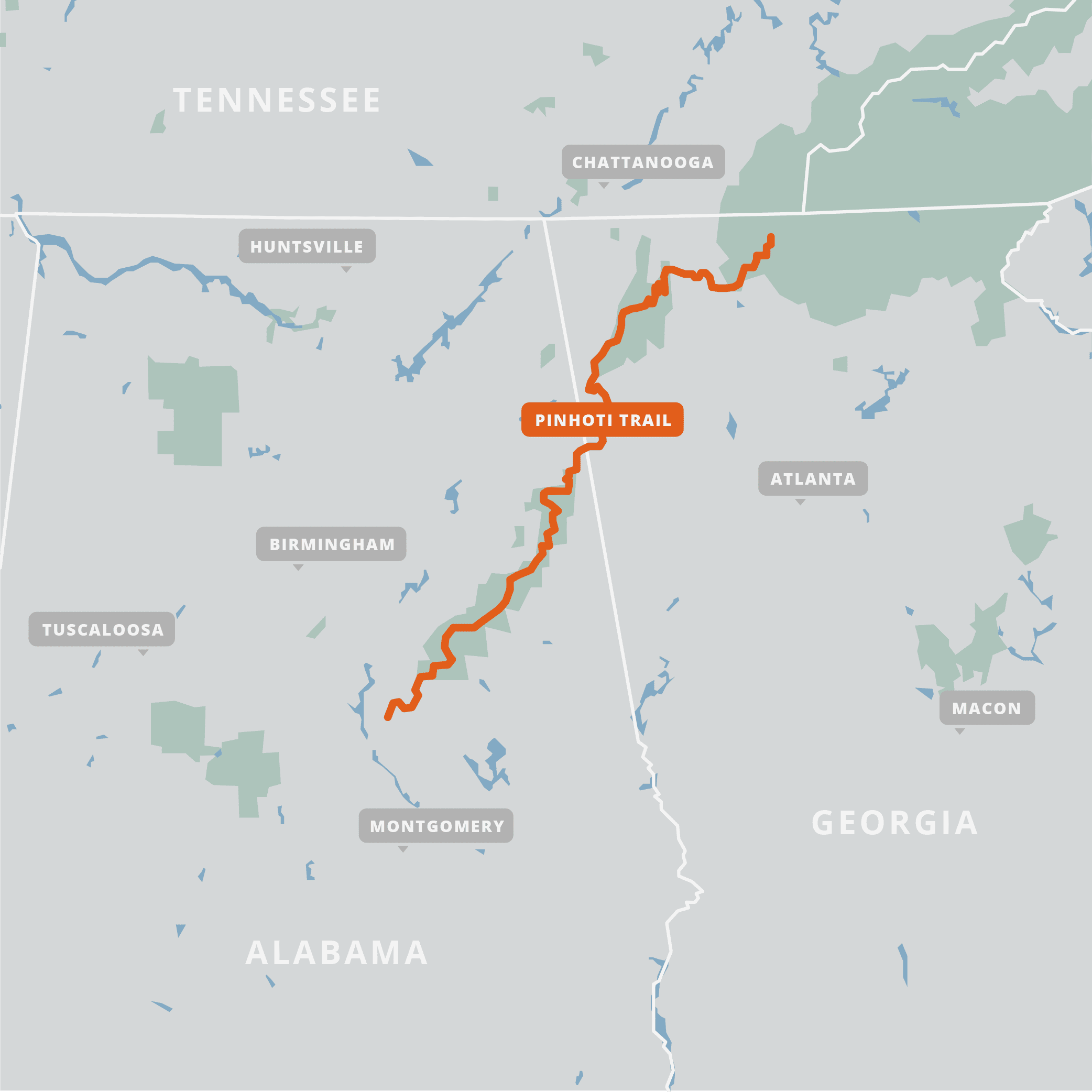
atlasguides.com
Pinhoti Hiking Trail – East Alabama Travel Destinations

toureastalabama.com
Pinhoti Trail Map – Route To Atlanta For Hiking
www.pinterest.com
PINHOTI TRAIL | GreenHippies
www.greenhippies.org
Pinhoti Trail Poster (Alabama, Georgia)
trailgoals.com
Pinhoti Trail Poster (Alabama, Georgia)


Leave a Comment